Your web browser is no longer supported. To improve your experience update it here
Australian weather forecast
National weather
Rain Radar map
11:15 AEST11:20 AEST11:25 AEST11:30 AEST11:35 AEST11:40 AEST11:45 AEST

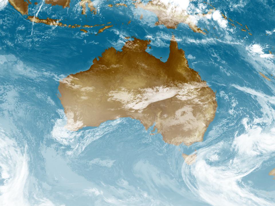
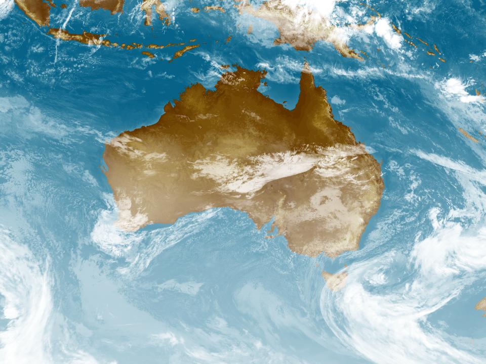
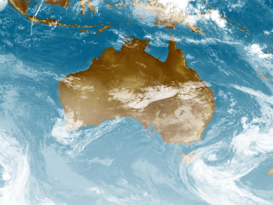
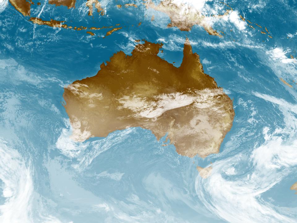
Weather Satellite
10:30 AEST10:40 AEST10:50 AEST11:00 AEST11:10 AEST11:20 AEST11:30 AEST


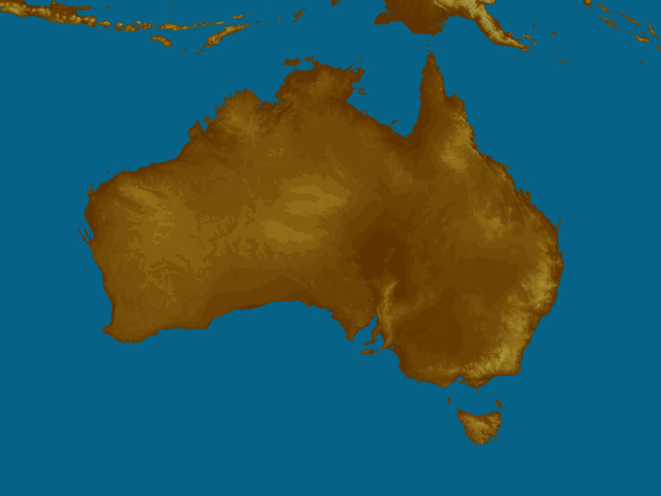
Synoptic weather chart
View national synoptic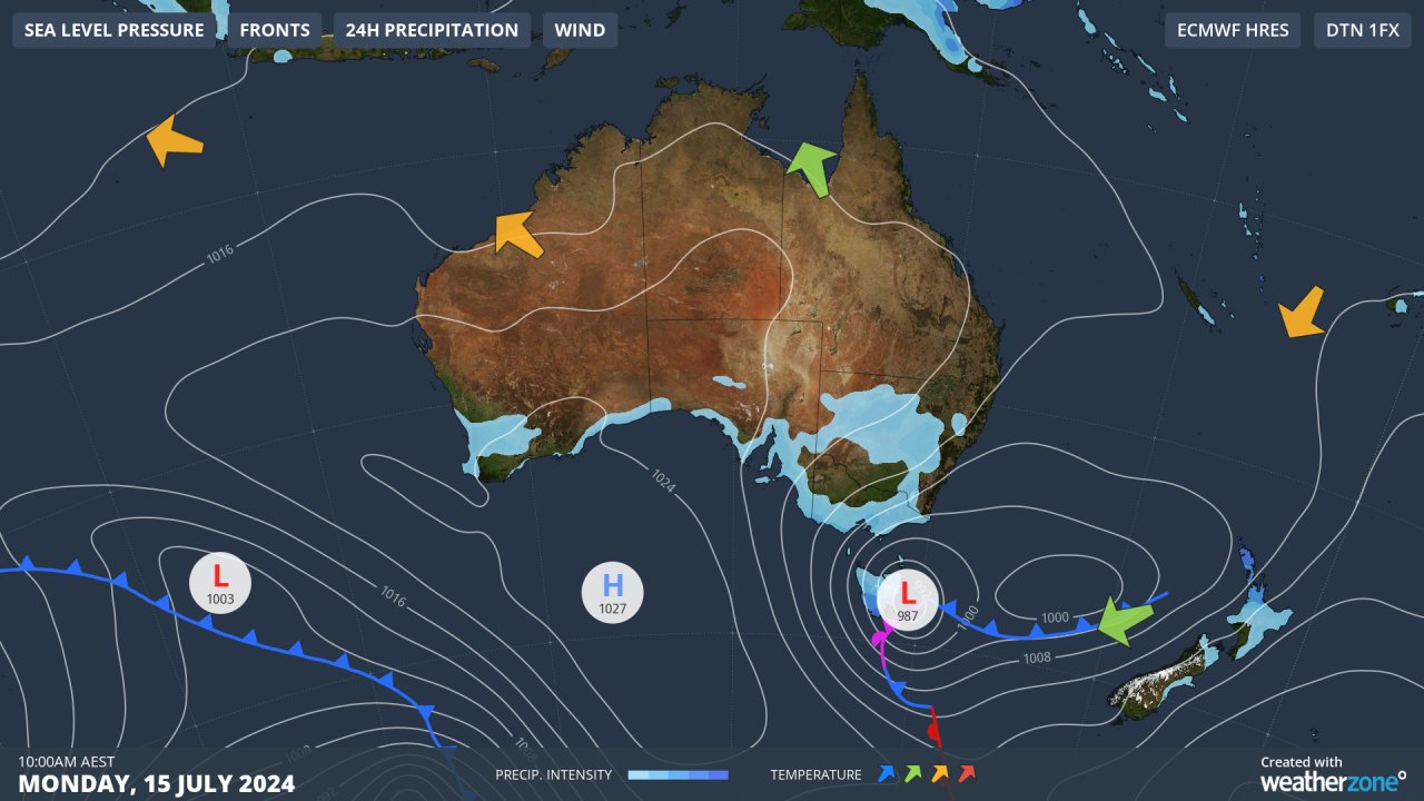
Sunday 00:07 EST
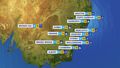
Strong winds around a low near TAS will bring a cold day to the southeast while triggering showers over VIC, TAS, SA's southeast & southern NSW. Showers should fall as snow on the alps. Moist winds should cause showers over QLD’s north coast & WA's south.
Issued Saturday 03:07 EST
Weather warnings
Gale Warning for Eden Coast. Strong Wind Warning for Batemans Coast. Cancellation for Illawarra Coast
Australian Government Bureau of Meteorology New South Wales Marine Wind Warning Summary for New South Wales Issued at 11:48 AM EST on Sunday 14 July 2024 for the period until midnight EST Monday 15 July 2024 Wind Warnings for Sunday 14 July Gale Warning for the following areas: Eden Coast Strong Wind Warning for the following areas: Batemans Coast Cancellation for the following areas: Illawarra Coast Wind Warnings for Monday 15 July Strong Wind Warning for the following areas: Macquarie Coast, Hunter Coast, Sydney Coast, Illawarra Coast, Batemans Coast and Eden Coast The next marine wind warning summary will be issued by 4:05 pm EST Sunday. ================================================================================ Check the latest Coastal Waters Forecast or Local Waters Forecast at http://www.bom.gov.au/nsw/forecasts/map.shtml for information on wind, wave and weather conditions for these coastal zones. ================================================================================Hazardous Surf Warning for Coffs, Macquarie, Hunter, Sydney, Illawarra, Batemans and Eden coasts. Cancellation for Byron Coast
Australian Government Bureau of Meteorology New South Wales Hazardous Surf Warning for New South Wales Issued at 11:40 AM EST on Sunday 14 July 2024 Weather Situation Surf and swell conditions are expected to be hazardous for coastal activities such as rock fishing, boating, and swimming in the following areas. Hazardous Surf Warning for the following areas: Coffs Coast, Macquarie Coast, Hunter Coast, Sydney Coast, Illawarra Coast, Batemans Coast and Eden Coast Cancellation for the following areas: Byron Coast Warnings for Monday 15 July Hazardous Surf Warning for the following areas: Hunter Coast, Sydney Coast, Illawarra Coast, Batemans Coast and Eden Coast Cancellation for the following areas: Byron Coast, Coffs Coast and Macquarie Coast NSW Police Force, Marine Area Command advise that: People should consider staying out of the water and avoid walking near surf-exposed areas. Rock fishers should avoid coastal rock platforms exposed to the ocean and seek a safe location that is sheltered from the surf. Boaters planning to cross shallow water and ocean bars should consider changing or delaying their voyage. Boaters already on the water should carry the appropriate safety equipment and wear a lifejacket. Boaters should remember to log on with their local Marine Rescue radio base, via VHF Radio or the Marine Rescue APP, and consider their safety management plan. The next warning will be issued by 5:00 pm EST Sunday. ================================================================================ Check the Coastal Waters Forecast for information on wind, wave and weather conditions for these areas at http://www.bom.gov.au/nsw/ or on marine radio. ================================================================================Cancellation of Surf Warning for Gold Coast Waters
Australian Government Bureau of Meteorology Queensland Cancellation of Hazardous Surf Warning for Queensland Issued at 11:31 AM EST on Sunday 14 July 2024 Weather Situation Hazardous surf conditions have now eased. Cancellation for the following areas: Gold Coast Waters The next warning will be issued by 5:00 pm EST Sunday. ================================================================================ Check the Coastal Waters Forecast for information on wind, wave and weather conditions for these areas at http://www.bom.gov.au/qld/ or on marine radio. ================================================================================Frost Warning for North East
Australian Government Bureau of Meteorology Victoria Frost Warning for North East forecast district Issued at 11:31 AM EST on Sunday 14 July 2024 ================================================================================ Please be aware Temperatures at ground level can be many degrees lower than those recorded by standard weather stations, especially in calm conditions with very clear skies. ================================================================================ Frost Warning for the following areas: North East forecast district Frosts with temperatures down to -1 degrees are forecast for Monday morning in parts of the North East forecast district. No further warnings will be issued for this event.Cancelled Road Weather Alert for Adelaide
Australian Government Bureau of Meteorology South Australia Cancellation of Road Weather Alert for Adelaide Issued at 10:50 AM CST on Sunday 14 July 2024 Cancelled road weather alert for the following areas: Adelaide The road weather alert for the Adelaide Area has been cancelled, but the situation will continue to be monitored and further alerts will be issued if necessary. For information on any road closures, please contact your local council or the Police. No further alerts will be issued for this event.Severe Weather Warning (Damaging Winds) King Island & Western, South East, North East, East Coast, NW Coast, CN, C Plateau & Midlands
Australian Government Bureau of Meteorology Tasmania TOP PRIORITY FOR IMMEDIATE BROADCAST Severe Weather Warning for Damaging Winds for King Island and parts of Western, South East, North East, East Coast, North West Coast, Central North, Central Plateau and Midlands Forecast Districts. Issued at 10:55 am Sunday, 14 July 2024. Damaging winds to develop from the late afternoon today and continue into Monday. Weather Situation A deep low pressure system is situated to the east in the Tasman Sea and is slowly approaching the state overnight before reaching close to the east coast during Monday. This will increase the south to southwesterly pressure gradient over the state, bringing areas of strong to damaging winds over eastern and central parts of the state during Sunday afternoon and evening, before extending the risk to western coastal areas and King Island during Monday. Conditions are expected to ease later on Monday as the low weakens and slowly moves to the north into Bass Strait. DAMAGING WINDS for the following areas: King Island, Western, South East, North East, East Coast, North West Coast, Central North, Central Plateau and Midlands For the exposed coasts and islands in the SOUTHEAST: South to southwesterly DAMAGING WINDS averaging 60 to 70 km/h with gusts up to 100 km/h are likely to develop from late Sunday afternoon and continue through into early Monday morning, easing by sunrise. For the WESTERN TIERS and elevated terrain in the NORTHEAST: South to southwesterly DAMAGING WINDS averaging 60 to 70 km/h with peak gusts up to 120 km/h are likely to develop from early Sunday evening. Winds are expected to ease during the late morning or early afternoon on Monday. For the WEST COAST and KING ISLAND: South to southwesterly DAMAGING WINDS averaging 60 to 70 km/h with gusts up to 100 km/h are likely to develop about coastal areas of the Western district before sunrise on Monday and extend to the far western parts of the North West Coast district and King Island later in the morning. Winds are likely to ease during the evening. Locations which may be affected include Currie, Sheffield, Deloraine and Strahan. The State Emergency Service advises that people should: * Supervise children closely. * Check that family and neighbours are aware of warnings. * Manage pets and livestock. * Secure outdoor items including furniture and play equipment. * Be prepared in case of power outages and report any outages to TasNetworks on 132 004. * Beware of damaged trees and power lines and take care when driving. * Listen to the ABC radio or check www.ses.tas.gov.au for further advice. * For emergency assistance contact the SES on 132500. The next Severe Weather Warning will be issued by 5:00 pm AEST Sunday. Warnings are also available through TV and Radio broadcasts, the Bureau's website at www.bom.gov.au or call 1300 659 210. The Bureau and State Emergency Service would appreciate warnings being broadcast regularly.Severe Weather Warning (Damaging Winds) King Island & Western, South East, North East, East Coast, NW Coast, CN, C Plateau & Midlands
Australian Government Bureau of Meteorology Tasmania TOP PRIORITY FOR IMMEDIATE BROADCAST Severe Weather Warning for Damaging Winds for King Island and parts of Western, South East, North East, East Coast, North West Coast, Central North, Central Plateau and Midlands Forecast Districts. Issued at 10:55 am Sunday, 14 July 2024. Damaging winds to develop from the late afternoon today and continue into Monday. Weather Situation A deep low pressure system is situated to the east in the Tasman Sea and is slowly approaching the state overnight before reaching close to the east coast during Monday. This will increase the south to southwesterly pressure gradient over the state, bringing areas of strong to damaging winds over eastern and central parts of the state during Sunday afternoon and evening, before extending the risk to western coastal areas and King Island during Monday. Conditions are expected to ease later on Monday as the low weakens and slowly moves to the north into Bass Strait. DAMAGING WINDS for the following areas: King Island, Western, South East, North East, East Coast, North West Coast, Central North, Central Plateau and Midlands For the exposed coasts and islands in the SOUTHEAST: South to southwesterly DAMAGING WINDS averaging 60 to 70 km/h with gusts up to 100 km/h are likely to develop from late Sunday afternoon and continue through into early Monday morning, easing by sunrise. For the WESTERN TIERS and elevated terrain in the NORTHEAST: South to southwesterly DAMAGING WINDS averaging 60 to 70 km/h with peak gusts up to 120 km/h are likely to develop from early Sunday evening. Winds are expected to ease during the late morning or early afternoon on Monday. For the WEST COAST and KING ISLAND: South to southwesterly DAMAGING WINDS averaging 60 to 70 km/h with gusts up to 100 km/h are likely to develop about coastal areas of the Western district before sunrise on Monday and extend to the far western parts of the North West Coast district and King Island later in the morning. Winds are likely to ease during the evening. Locations which may be affected include Currie, Sheffield, Deloraine and Strahan. The State Emergency Service advises that people should: * Supervise children closely. * Check that family and neighbours are aware of warnings. * Manage pets and livestock. * Secure outdoor items including furniture and play equipment. * Be prepared in case of power outages and report any outages to TasNetworks on 132 004. * Beware of damaged trees and power lines and take care when driving. * Listen to the ABC radio or check www.ses.tas.gov.au for further advice. * For emergency assistance contact the SES on 132500. The next Severe Weather Warning will be issued by 5:00 pm AEST Sunday. Warnings are also available through TV and Radio broadcasts, the Bureau's website at www.bom.gov.au or call 1300 659 210. The Bureau and State Emergency Service would appreciate warnings being broadcast regularly.Severe Weather Warning (Damaging Winds) for parts of West and South Gippsland, Central and South West
Australian Government Bureau of Meteorology Victoria TOP PRIORITY FOR IMMEDIATE BROADCAST Severe Weather Warning for Damaging Winds for parts of West and South Gippsland, Central and South West Forecast Districts. Issued at 10:54 am Sunday, 14 July 2024. Damaging winds developing along parts of the southwest facing southern coasts and Mt Baw Baw from Monday afternoon. Weather Situation A complex low pressure system currently lies to the northeast of Tasmania. This low is forecast to track towards the Bass Strait during Monday, with a series of associated troughs crossing Victoria, resulting in strengthening southwesterly winds along parts of the coastline and Mt Baw Baw. DAMAGING WINDS for the following areas: Central, South West and West and South Gippsland For parts of the SOUTHWEST FACING SOUTHERN COASTS: DAMAGING WINDS averaging 60 to 70 km/h with peak gusts of around 90 km/h are possible for parts of the coastal fringe extending from Port Campbell to Wilsons Promontory from late Monday afternoon, easing overnight. For MT BAW BAW: Strong winds averaging 50 to 60 km/h with DAMAGING WIND GUSTS of around 90 km/h are possible from the early afternoon, easing overnight. Locations which may be affected include Wonthaggi, Rosebud, Tidal River and Mt Baw Baw. The State Emergency Service advises that people should: * If driving conditions are dangerous, safely pull over away from trees, drains, low-lying areas and floodwater. Avoid travel if possible. * Stay safe by avoiding dangerous hazards, such as floodwater, mud, debris, damaged roads and fallen trees. * Be aware - heat, fire or recent storms may make trees unstable and more likely to fall when it's windy or wet. * Check that loose items, such as outdoor settings, umbrellas and trampolines are safely secured. Move vehicles under cover or away from trees. * Stay indoors and away from windows. * If outdoors, move to a safe place indoors. Stay away from trees, drains, gutters, creeks and waterways. * Stay away from fallen powerlines - always assume they are live. * Be aware that in fire affected areas, rainfall run-off into waterways may contain debris such as ash, soil, trees and rocks. Heavy rainfall may also increase the potential for landslides and debris across roads. * Stay informed: Monitor weather warnings, forecasts and river levels at the Bureau of Meteorology website, and warnings through VicEmergency website/app/hotline. The next Severe Weather Warning will be issued by 5:00 pm AEST Sunday. Warnings are also available through TV and Radio broadcasts, the Bureau's website at www.bom.gov.au or call 1300 659 210. The Bureau and State Emergency Service would appreciate warnings being broadcast regularly.Severe Weather Warning (Damaging Winds) for parts of West and South Gippsland, Central and South West
Australian Government Bureau of Meteorology Victoria TOP PRIORITY FOR IMMEDIATE BROADCAST Severe Weather Warning for Damaging Winds for parts of West and South Gippsland, Central and South West Forecast Districts. Issued at 10:54 am Sunday, 14 July 2024. Damaging winds developing along parts of the southwest facing southern coasts and Mt Baw Baw from Monday afternoon. Weather Situation A complex low pressure system currently lies to the northeast of Tasmania. This low is forecast to track towards the Bass Strait during Monday, with a series of associated troughs crossing Victoria, resulting in strengthening southwesterly winds along parts of the coastline and Mt Baw Baw. DAMAGING WINDS for the following areas: Central, South West and West and South Gippsland For parts of the SOUTHWEST FACING SOUTHERN COASTS: DAMAGING WINDS averaging 60 to 70 km/h with peak gusts of around 90 km/h are possible for parts of the coastal fringe extending from Port Campbell to Wilsons Promontory from late Monday afternoon, easing overnight. For MT BAW BAW: Strong winds averaging 50 to 60 km/h with DAMAGING WIND GUSTS of around 90 km/h are possible from the early afternoon, easing overnight. Locations which may be affected include Wonthaggi, Rosebud, Tidal River and Mt Baw Baw. The State Emergency Service advises that people should: * If driving conditions are dangerous, safely pull over away from trees, drains, low-lying areas and floodwater. Avoid travel if possible. * Stay safe by avoiding dangerous hazards, such as floodwater, mud, debris, damaged roads and fallen trees. * Be aware - heat, fire or recent storms may make trees unstable and more likely to fall when it's windy or wet. * Check that loose items, such as outdoor settings, umbrellas and trampolines are safely secured. Move vehicles under cover or away from trees. * Stay indoors and away from windows. * If outdoors, move to a safe place indoors. Stay away from trees, drains, gutters, creeks and waterways. * Stay away from fallen powerlines - always assume they are live. * Be aware that in fire affected areas, rainfall run-off into waterways may contain debris such as ash, soil, trees and rocks. Heavy rainfall may also increase the potential for landslides and debris across roads. * Stay informed: Monitor weather warnings, forecasts and river levels at the Bureau of Meteorology website, and warnings through VicEmergency website/app/hotline. The next Severe Weather Warning will be issued by 5:00 pm AEST Sunday. Warnings are also available through TV and Radio broadcasts, the Bureau's website at www.bom.gov.au or call 1300 659 210. The Bureau and State Emergency Service would appreciate warnings being broadcast regularly.Severe Weather Warning (Damaging Winds) for parts of Snowy Mountains
Australian Government Bureau of Meteorology New South Wales TOP PRIORITY FOR IMMEDIATE BROADCAST Severe Weather Warning for Damaging Winds for parts of Snowy Mountains Forecast District. Issued at 10:51 am Sunday, 14 July 2024. Vigorous alpine winds with blizzard conditions possible from Monday afternoon. Weather Situation A complex low pressure system currently lies to the northeast of Tasmania. This low is forecast to track towards the Bass Strait during Monday, with a series of associated troughs crossing NSW, resulting in strengthening westerly winds. DAMAGING WINDS for the following areas: Snowy Mountains DAMAGING WINDS, averaging 80 to 90 km/h with peak gusts of around 115 km/h are likely, along with BLIZZARD conditions over alpine areas over 1900 metres from Monday afternoon, easing early Tuesday morning. The NSW National Parks and Wildlife Service recommends that back country travel be postponed until conditions improve. Locations which may be affected include Thredbo Top Station. The State Emergency Service advises that people should: * Move vehicles under cover or away from trees. * Secure or put away loose items around your house, yard and balcony. * Keep at least 8 metres away from fallen power lines or objects that may be energised, such as fences. * Trees that have been damaged by fire are likely to be more unstable and more likely to fall. * Report fallen power lines to either Ausgrid (131 388), Endeavour Energy (131 003), Essential Energy (132 080) or Evoenergy (131 093) as shown on your power bill. * Stay vigilant and monitor conditions. Note that the landscape may have changed following bushfires. * For emergency help in floods and storms, ring your local SES Unit on 132 500. The next Severe Weather Warning will be issued by 5:00 pm AEST Sunday. Warnings are also available through TV and Radio broadcasts, the Bureau's website at www.bom.gov.au or call 1300 659 210. The Bureau and State Emergency Service would appreciate warnings being broadcast regularly.Severe Weather Warning (Damaging Winds) for parts of Snowy Mountains
Australian Government Bureau of Meteorology New South Wales TOP PRIORITY FOR IMMEDIATE BROADCAST Severe Weather Warning for Damaging Winds for parts of Snowy Mountains Forecast District. Issued at 10:51 am Sunday, 14 July 2024. Vigorous alpine winds with blizzard conditions possible from Monday afternoon. Weather Situation A complex low pressure system currently lies to the northeast of Tasmania. This low is forecast to track towards the Bass Strait during Monday, with a series of associated troughs crossing NSW, resulting in strengthening westerly winds. DAMAGING WINDS for the following areas: Snowy Mountains DAMAGING WINDS, averaging 80 to 90 km/h with peak gusts of around 115 km/h are likely, along with BLIZZARD conditions over alpine areas over 1900 metres from Monday afternoon, easing early Tuesday morning. The NSW National Parks and Wildlife Service recommends that back country travel be postponed until conditions improve. Locations which may be affected include Thredbo Top Station. The State Emergency Service advises that people should: * Move vehicles under cover or away from trees. * Secure or put away loose items around your house, yard and balcony. * Keep at least 8 metres away from fallen power lines or objects that may be energised, such as fences. * Trees that have been damaged by fire are likely to be more unstable and more likely to fall. * Report fallen power lines to either Ausgrid (131 388), Endeavour Energy (131 003), Essential Energy (132 080) or Evoenergy (131 093) as shown on your power bill. * Stay vigilant and monitor conditions. Note that the landscape may have changed following bushfires. * For emergency help in floods and storms, ring your local SES Unit on 132 500. The next Severe Weather Warning will be issued by 5:00 pm AEST Sunday. Warnings are also available through TV and Radio broadcasts, the Bureau's website at www.bom.gov.au or call 1300 659 210. The Bureau and State Emergency Service would appreciate warnings being broadcast regularly.Sheep Graziers Warning for Northern Country, North Central, North East, South West, Central, West and South Gippsland and East Gippsland
Australian Government Bureau of Meteorology Victoria Warning to Sheep Graziers for Northern Country, North Central, North East, South West, Central, West and South Gippsland and East Gippsland forecast districts Issued at 10:49 AM EST on Sunday 14 July 2024 Warning to Sheep Graziers for the following areas: Northern Country, North Central, North East, South West, Central, West and South Gippsland and East Gippsland forecast districts Sheep graziers are warned that cold temperatures, rain and showers and westerly winds are expected during Monday. Areas likely to be affected include the South West, Central and West and South Gippsland forecast districts and parts of the Northern Country, North Central, North East and East Gippsland forecast districts. There is a risk of losses of lambs and sheep exposed to these conditions. The next warning will be issued by 5:00 pm EST Sunday.Sheep Graziers Warning for Midlands, South East & East Coast. Cancellation of Sheep Graziers Warning for Furneaux Islands
Australian Government Bureau of Meteorology Tasmania Warning to Sheep Graziers for Midlands, East Coast and South East forecast districts Issued at 10:49 AM EST on Sunday 14 July 2024 Warning to Sheep Graziers for the following areas: Midlands, East Coast and South East forecast districts Sheep graziers are warned that cold temperatures, rain and showers and strong southwesterly winds are expected during Sunday and Monday. Areas likely to be affected include parts of the Midlands, East Coast and South East forecast districts. There is a risk of losses of lambs and sheep exposed to these conditions. Cancellation of Warning to Sheep Graziers for the following areas: Furneaux Islands forecast district The Warning to Sheep Graziers for the Furneaux Islands forecast district has been cancelled. The next warning will be issued by 5:00 pm EST Sunday.Sheep Graziers Warning Northern Tablelands, Illawarra, Central Tablelands, Southern Tablelands, South West Slopes, Snowy Mountains & ACT
Australian Government Bureau of Meteorology New South Wales Warning to Sheep Graziers for Northern Tablelands, Illawarra, Central Tablelands, Southern Tablelands, South West Slopes, Snowy Mountains and Australian Capital Territory forecast districts Issued at 10:49 AM EST on Sunday 14 July 2024 Warning to Sheep Graziers for the following areas: Northern Tablelands, Illawarra, Central Tablelands, Southern Tablelands, South West Slopes, Snowy Mountains and Australian Capital Territory forecast districts Sheep graziers are warned that cold temperatures, rain and showers and westerly winds are expected during Sunday and Monday. Areas likely to be affected include the Southern Tablelands, South West Slopes, Snowy Mountains and Australian Capital Territory forecast districts and parts of the Northern Tablelands, Illawarra and Central Tablelands forecast districts. There is a risk of losses of lambs and sheep exposed to these conditions. Cancellation of Warning to Sheep Graziers for the following areas: Riverina forecast district The Warning to Sheep Graziers for the Riverina forecast district has been cancelled. The next warning will be issued by 5:00 pm EST Sunday.Strong Wind Warning for Monday for Lower South East Coast
Australian Government Bureau of Meteorology South Australia Marine Wind Warning Summary for South Australia Issued at 10:00 AM CST on Sunday 14 July 2024 for the period until midnight CST Monday 15 July 2024 Wind Warnings for Monday 15 July Strong Wind Warning for the following areas: Lower South East Coast The next marine wind warning summary will be issued by 3:50 pm CST Sunday. ================================================================================ Check the latest Coastal Waters Forecast or Local Waters Forecast at http://www.bom.gov.au/sa/forecasts/map.shtml for information on wind, wave and weather conditions for these coastal zones. ================================================================================Gale Warning East of Flinders Is, Derwent, Fred Hen Bay & Norfolks, Storm Bay, Channel & Far NW, Upper East, Lower E, SE, SW & CW coasts
Australian Government Bureau of Meteorology Tasmania Marine Wind Warning Summary for Tasmania Issued at 10:00 AM EST on Sunday 14 July 2024 for the period until midnight EST Monday 15 July 2024 Wind Warnings for Sunday 14 July Gale Warning for the following areas: Derwent Estuary, Frederick Henry Bay and Norfolk Bay, Storm Bay, Channel, Far North West Coast, East of Flinders Island, Upper East Coast, Lower East Coast, South East Coast, South West Coast and Central West Coast Strong Wind Warning for the following areas: Central Plateau Lakes, Central North Coast and Banks Strait and Franklin Sound Wind Warnings for Monday 15 July Gale Warning for the following areas: Far North West Coast, Central North Coast, East of Flinders Island, Upper East Coast, Lower East Coast, South East Coast, South West Coast and Central West Coast Strong Wind Warning for the following areas: Derwent Estuary, Frederick Henry Bay and Norfolk Bay, Storm Bay, Channel, Central Plateau Lakes and Banks Strait and Franklin Sound The next marine wind warning summary will be issued by 4:05 pm EST Sunday. ================================================================================ Check the latest Coastal Waters Forecast or Local Waters Forecast at http://www.bom.gov.au/tas/forecasts/map.shtml for information on wind, wave and weather conditions for these coastal zones. ================================================================================Gale Warning for East Gippsland Coast. Strong Wind Warning for Central and Central Gippsland coasts
Australian Government Bureau of Meteorology Victoria Marine Wind Warning Summary for Victoria Issued at 10:00 AM EST on Sunday 14 July 2024 for the period until midnight EST Monday 15 July 2024 Wind Warnings for Sunday 14 July Gale Warning for the following areas: East Gippsland Coast Strong Wind Warning for the following areas: Central Coast and Central Gippsland Coast Wind Warnings for Monday 15 July Gale Warning for the following areas: West Coast, Central Coast, Central Gippsland Coast and East Gippsland Coast Strong Wind Warning for the following areas: Port Phillip, Western Port and Gippsland Lakes The next marine wind warning summary will be issued by 4:40 pm EST Sunday. ================================================================================ Check the latest Coastal Waters Forecast or Local Waters Forecast at http://www.bom.gov.au/vic/forecasts/map.shtml for information on wind, wave and weather conditions for these coastal zones. ================================================================================Final Gale Warning For Southern Area
Australian Government Bureau of Meteorology Head Office (Bureau National Operations Centre) Final Gale Warning For Southern Area Issued at 03:56 AM EST on Sunday 14 July 2024 ================================================================================ Please be aware Wind and wave forecasts are averages. Wind gusts can be 40 per cent stronger than the forecast, and stronger still in squalls and thunderstorms. Maximum waves can be twice the forecast height. ================================================================================ Weather Situation Vigorous northwesterly flow. No further warnings will be issued for this event.Flood Watch For Parts Of The North, North East, Huon, Derwent And South East Catchments
Australian Government Bureau of Meteorology, Tasmania This Flood Watch provides early advice of possible flooding within the specified catchments. Flood Watch For Parts Of The North, North East, Huon, Derwent And South East Catchments Issued at 12:32 PM EST on Saturday 13 July 2024 By the Bureau of Meteorology, Hobart. Flood Watch Number: 2 MINOR FLOODING WITH ISOLATED MODERATE FLOODING POSSIBLE ACROSS PARTS OF THE NORTH, NORTH EAST, HUON, DERWENT AND SOUTH EAST CATCHMENTS FROM MONDAY A low pressure system approaches the east of Tasmania during Sunday, which is expected to intensify and bring rain to the North, North East, Huon, Derwent and South East catchments from late Sunday. Catchments in the Flood Watch area are relatively wet. Widespread rainfall totals of 20 to 50 mm are forecast over the Flood Watch area from late Sunday into Monday, with isolated totals of 80 to 100 mm possible. Further rainfall totals of 25 to 35 mm are possible across parts of the Flood Watch area during Tuesday. Minor flooding with isolated moderate flooding may develop across the Flood Watch area from early Monday morning. Catchments likely to be affected include: South Esk River Macquarie River Huon River Channel Coastal Rivers (South East Cape to Gordon) Derwent River Jordan River Coal River East Coastal Rivers (south of Bicheno) South East Note: This Flood Watch is a "heads up" for possible future flooding and is NOT a Flood Warning. The Bureau of Meteorology does not provide a flood warning service for all of the catchments covered by this flood watch. For more information on the Flood Watch Service: http://www.bom.gov.au/water/floods/floodWarningServices.shtml For the latest warnings see www.bom.gov.au/tas/warnings For the latest rainfall and river level information see www.bom.gov.au/tas/flood For the latest weather forecast see www.bom.gov.au/tas/forecasts Flood Safety Advice: For emergency assistance call the SES on telephone number 132 500. For life threatening situations, call 000 immediately. SES flood warnings can be found at TasALERT.com Flood and storm safety advice is available at www.ses.tas.gov.au Road closure information is available at www.police.tas.gov.au} Next issue: The next Flood Watch will be issued by 01:00 pm EST on Sunday 14 July 2024.Final Flood Warning For The Inland Rivers Sa
Australian Government Bureau of Meteorology, South Australia Final Flood Warning For The Inland Rivers Sa Issued at 11:31 AM CST on Thursday 11 July 2024 Flood Warning Number: 3 FLOODING NO LONGER OCCURRING ALONG THE COOPER CREEK AT INNAMINCKA No significant rainfall is forecast for the coming days. River levels along the Cooper Creek continue to fall and flooding at Innamincka is no longer occurring. Cooper Creek: The Cooper Creek at Cullyamurra Waterhole is currently near 2.0 metres and falling. The river level at Innamincka is estimated to be around the level of the causeway (1.70 metres) and falling. Flood Safety Advice: People living or working along rivers and streams should monitor the latest weather forecasts and warnings. For the latest SA Warnings refer to www.bom.gov.au/sa/warnings For more information on the Flood Warning and Flood Watch Service: www.bom.gov.au/water/floods/floodWarningServices.shtml} For flood emergency assistance contact the State Emergency Service on 132 500. For life threatening emergencies call Triple Zero (000) immediately. Next issue: This is a final warning, no further warnings will be issued for this event. Latest River Heights: Cooper Creek at Cullyamurra Waterhole,1.98,Steady,11:00 AM THU 11/07/24 This advice is also available by dialling 1300 659 210. Warning, rainfall and river information are available at www.bom.gov.au/sa/flood. The latest weather forecast is available at www.bom.gov.au/sa/forecasts.
Weather Articles
Data supplied byWeather Zone
News Just In

Shooting at Donald Trump rally being investigated as assassination attempt

What do we know about the shooter behind the attack on Donald Trump?

How the shooting attack on Donald Trump unfolded

Donald Trump rally shooting: What we know

Trump says he was 'shot with bullet' in social media post

'Praying for him': Joe Biden speaks after Donald Trump shooting

Biden condemns 'sick' shooting at Trump rally

Two dead, Trump doing 'fine' after gunshots fired at campaign rally

Watch: Video captures what happened at Trump rally